By Dan Shryock
Our adventure began with a book, “75 Classic Rides Oregon: the Best Road Biking Routes.” In it, author/rider Jim Moore features “a picture-postcard ride to the border.” This is a 60-plus-mile loop to Applegate Lake, a reservoir that stretches to the Oregon-California line. For the record, there is about 3,200 feet of elevation gain on this route.
The best parts of this ride may not be the ups and downs but instead the historical mile markers, the picture postcards of the past along the way.
We started in Jacksonville, the pristine gold rush-era town five miles west of Medford. Heading southwest up and over Sterling Creek Road, we sped downhill through the trees and rolled up to a stop sign at Little Applegate Road.
An abandoned building indicated there once was life here. Welcome to Buncom, a bustling mining town from the 1850s through the turn of the century. Once the mines played out and the post office closed in 1916, the town was abandoned. It is now one of Oregon’s many ghost towns, and that structure is a weather-beaten reminder of what was here.
Pushing south onto Upper Applegate Road, it takes only nine miles to reach the edge of the Rogue River-Siskiyou National Forest and find the old McKee Bridge, an historic covered bridge that served the miners and loggers from 1917 to 1956 until it was declared unsafe. The small span over the Applegate River stood abandoned for more than 30 years before it was preserved in the late 1980s for pedestrian use and history.
Right next to the bridge is the McKee Bridge Day Use Area, a great rest stop with running water and shelter from the sun or rain. The road continues toward California. One good uphill push and the blue of Applegate Lake splashes before your eyes.

The lake and its 242-foot-high dam were formed in 1980 as a flood control project. The 988-acre lake and the nearby forest now provide a variety of outdoor recreation choices.
Take an early left turn and ride to the end of a fishing pier for an expansive view. Then continue back on the road and drop down to the water’s edge and Hart-Tish Park. While there’s a small store, campgrounds and tap water here, the main attraction is a picnic bench with views east across the water.
Back on the bike, choose to return north or ride four more miles south to the California border. From there, it’s 27 miles back to Jacksonville where a downhill glide into town is a delight after a hard day in the saddle.
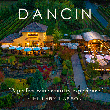
Once the bikes are on the rack, find a place for some recovery and relaxation. There are plenty of choices. We headed to DANCIN Vineyards on the edge of town where owners Dan and Cindy Marca welcomed us with a patio table overlooking their garden and vineyard. The appetizers were great, and the pinot noir was outstanding.